


SO Weissenstein -Grenchenberg

hrb
User

Length
9.7 km

Max alt
1431 m

Uphill gradient
511 m
Km-Effort
16.3 km

Min alt
1173 m

Downhill gradient
445 m
Boucle
No
Creation date :
2014-12-11 00:00:00.0
Updated on :
2014-12-11 00:00:00.0
--
Difficulty : Unknown

FREE GPS app for hiking
 SityTrail
IGN / Geographical institutes
SityTrail Plus
The world is yours!
About
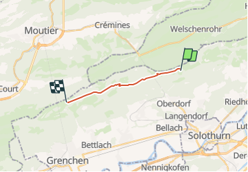
Trail Other activity of 9.7 km to be discovered at Solothurn, Bezirk Lebern, Oberdorf (SO). This trail is proposed by hrb.
Description
Mit Grottenbesichtigung, Quelle der Orbe
Positioning
Country:
Switzerland
Region :
Solothurn
Department/Province :
Bezirk Lebern
Municipality :
Oberdorf (SO)
Location:
Unknown
Start:(Dec)
Start:(UTM)
387285 ; 5234269 (32T) N.
Comments